Shah wa Arüs
Download PDF data sheet
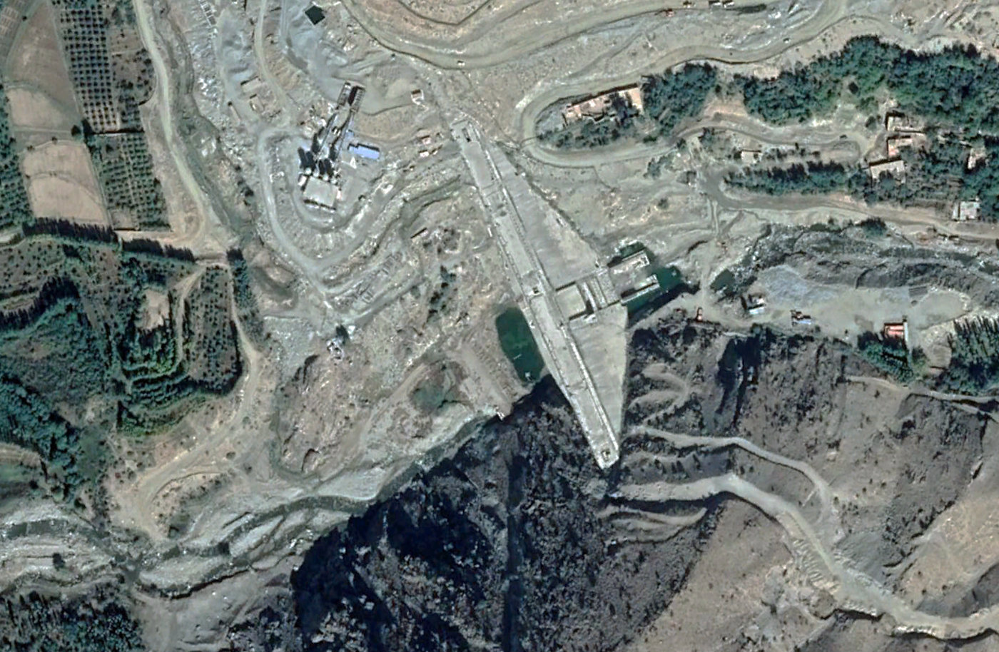
Shah wa Arüs on Google Earth
Statistics
Type: Gravity
Purpose(s): Flood Control / Hydropower / Irrigation / Water Supply
Reservoir capacity: 10 m3x106
Height: 78 metres
Length: 303 metres
Volume of RCC: 270 m3x103
Total volume: 337 m3x103
Construction Dates
Start of Project: —/12 (— 2012)
Start of RCC: —/13 (— 2013)
End of RCC: —/19 (— 2019)
End of Project: 04/21 (April 2021)
Country: Afghanistan
River: Shakardar
DMS Co-ordinates: 34˚41'15.62"N, 69˚1'2.92"E
DD Co-ordinates: 34.687969, 69.017479
Facings
Upstream
| Slope | Type |
|---|---|
| Vertical | Traditional concrete against formwork |
| 0.20 |
Downstream
| Slope | Type |
|---|---|
| 0.80 | Traditional concrete against formwork [stepped face] |
Spillway
| Slope | Type |
|---|---|
| 0.80 | Traditional concrete against formwork |
Placement
| Layers (mm) | Lifts (mm) |
|---|---|
| 300 | 300 |
Cementitious material
| Cement (kg/m3) |
|---|
| 105 |
| Pozzolan (kg/m3) | Pozzolan Type |
|---|---|
| 45 | Natural pozzolan (ASTM Class N) |