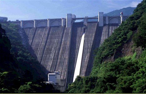
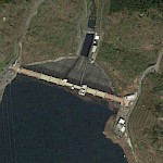
Urayama
Download PDF data sheet
Urayama completed

Particulars
Owner: unknown
Designer: Water Resources Development Public Corporation
Contractor: Tobishima Construction Co Ltd, Hazama-gumi Co Ltd, and Takenaka Doboku Co Ltd J.V.
Statistics
Type: Gravity
Purpose(s): Flood Control / Hydropower / Water Supply
Reservoir capacity: 58 m3x106
Height: 156 metres
Length: 372 metres
Volume of RCC: 1294 m3x103
Total volume: 1750 m3x103
Construction Dates
Start of Project: 03/90 (March 1990)
Start of RCC: 12/92 (December 1992)
End of RCC: 12/95 (December 1995)
End of Project: 03/99 (March 1999)
Country: Japan
River: Urayama
DMS Co-ordinates: 35˚57'12.74"N, 139˚3'8.69"E
DD Co-ordinates: 35.953541, 139.052414
Facings
Upstream
| Slope | Type |
|---|---|
| Vertical | Traditional concrete against formwork |
| 0.65 | Traditional concrete against formwork |
Downstream
| Slope | Type |
|---|---|
| 0.80 | Traditional concrete against formwork |
Spillway
| Slope | Type |
|---|---|
| 0.80 | Traditional concrete against formwork |
Placement
| Layers (mm) | Lifts (mm) |
|---|---|
| 250 | 750 |
| 1000 |
Cementitious material
| Cement (kg/m3) |
|---|
| 91 |
| Pozzolan (kg/m3) | Pozzolan Type |
|---|---|
| 39 | Low-lime flyash (ASTM Class F) |


